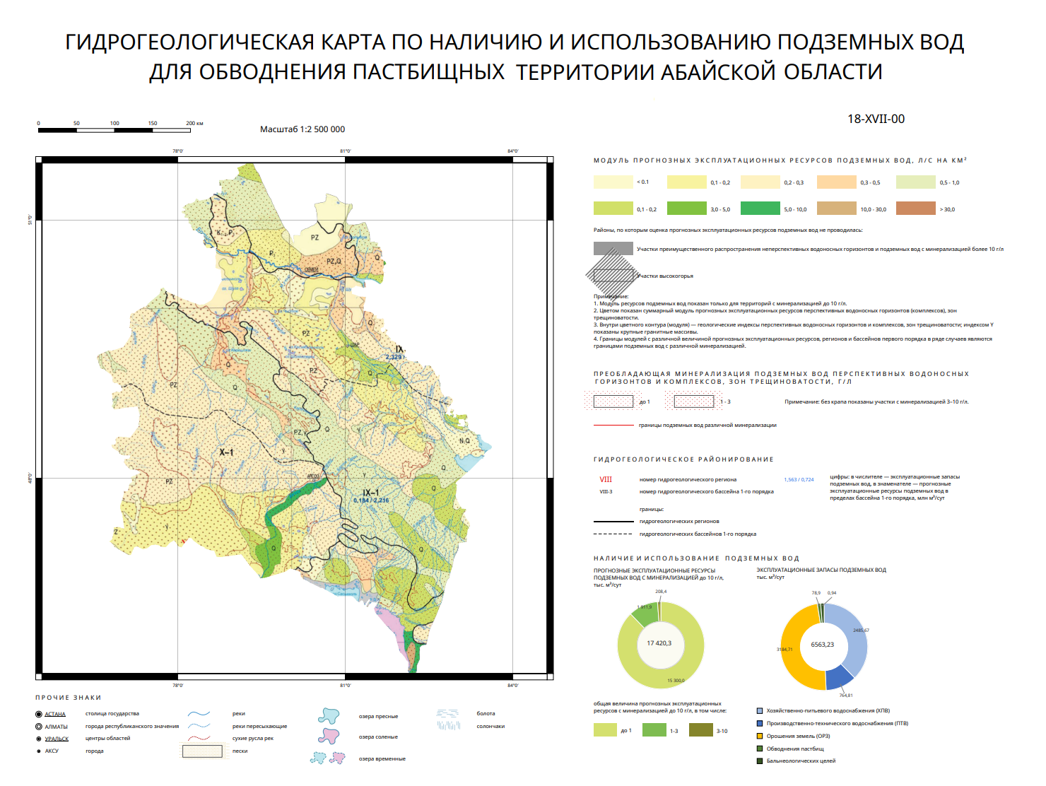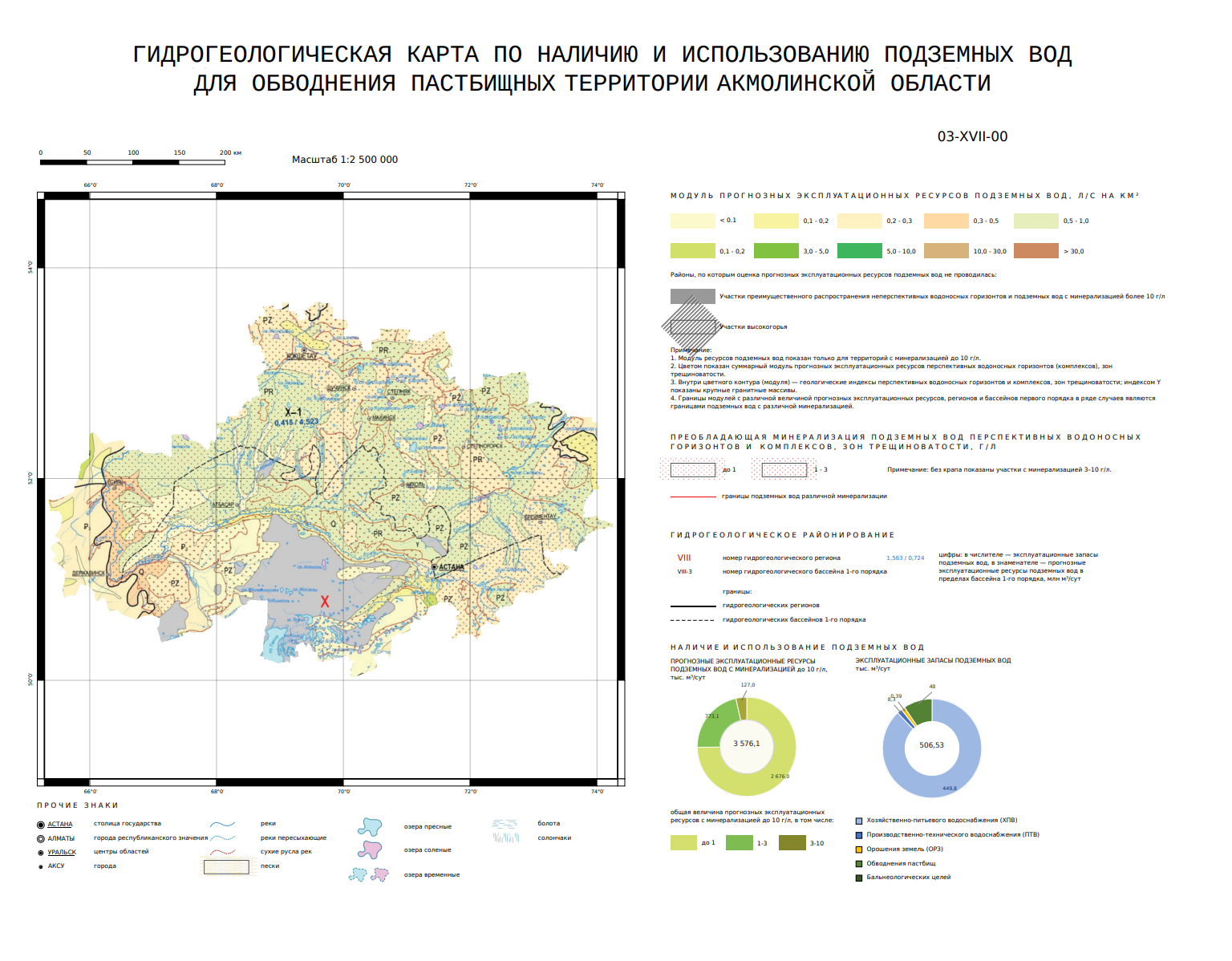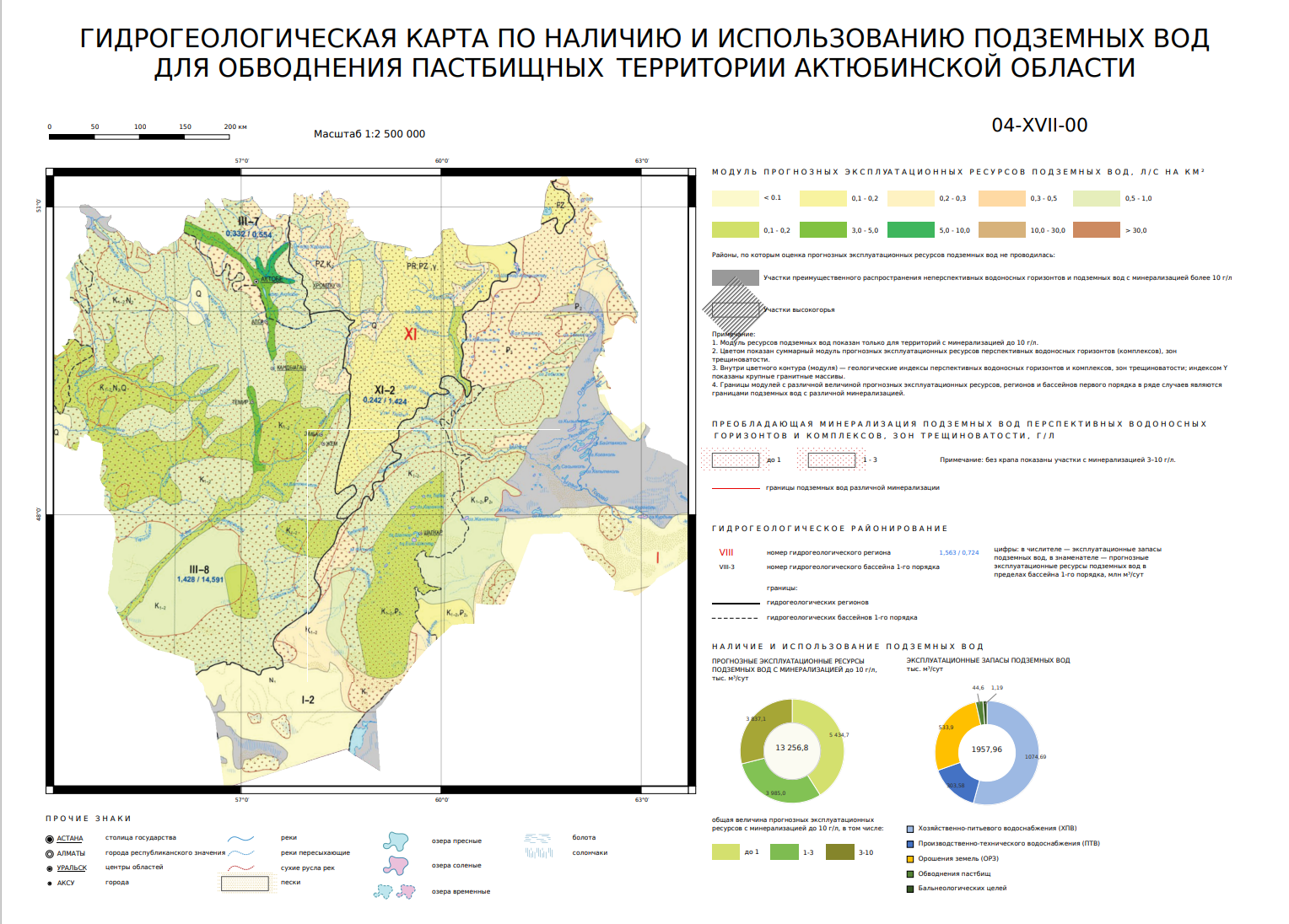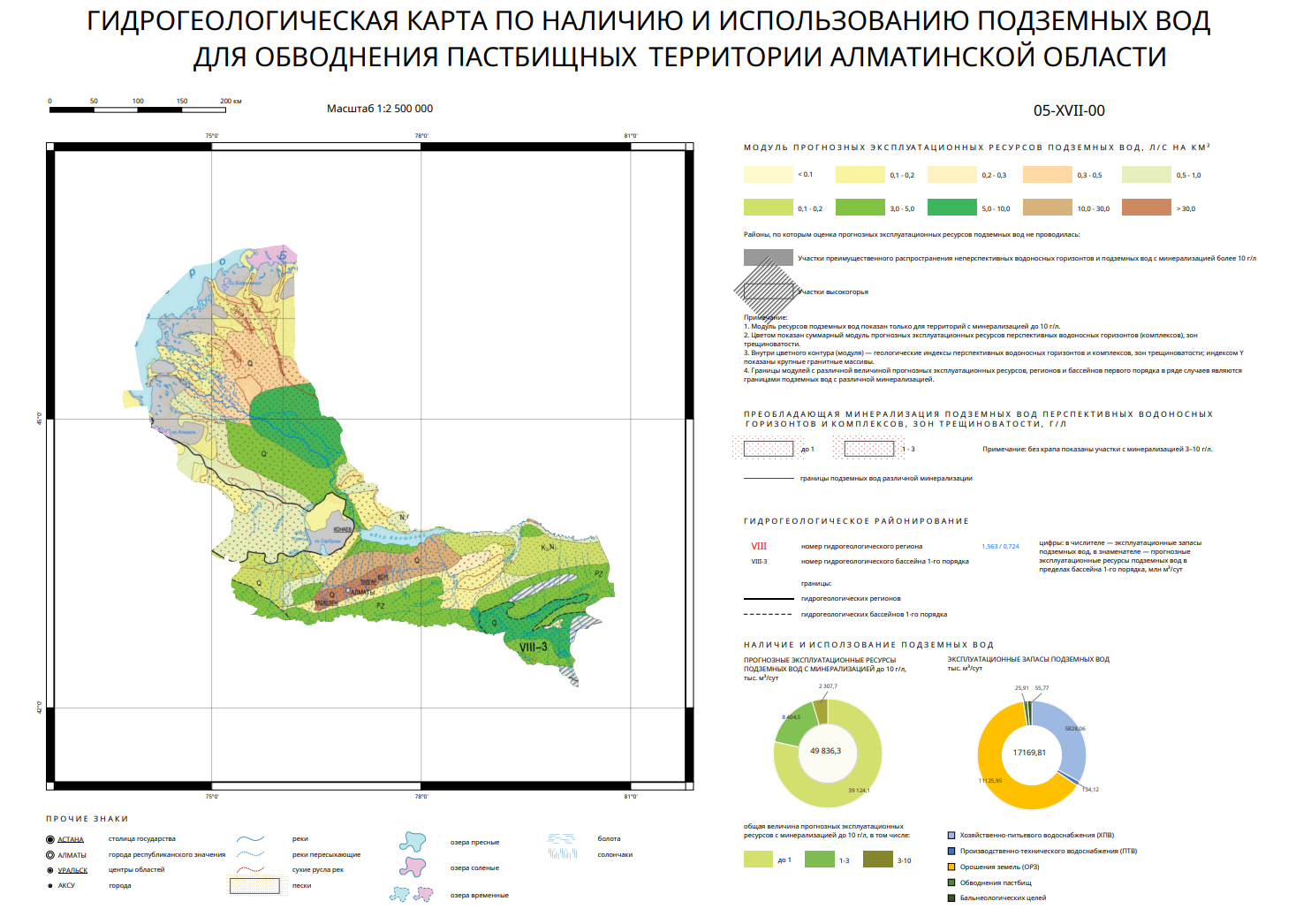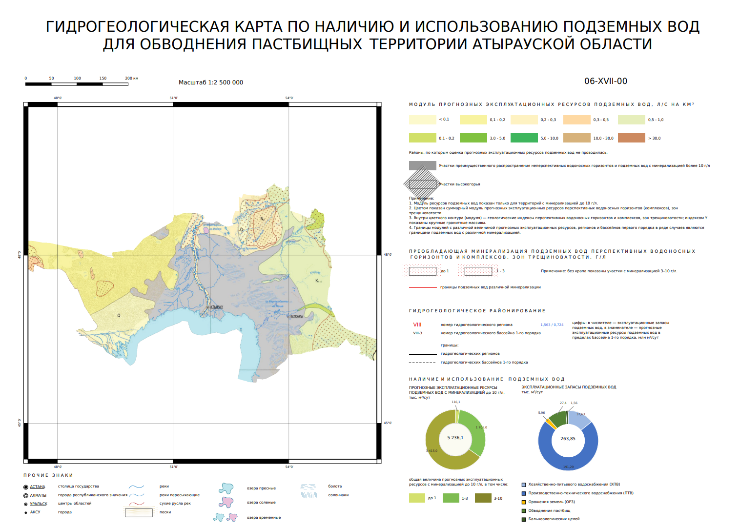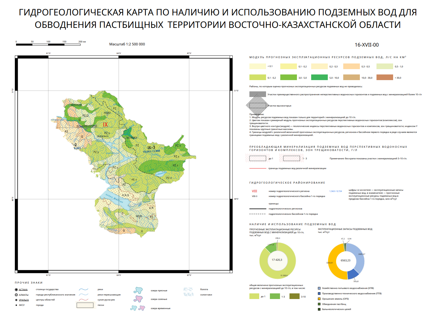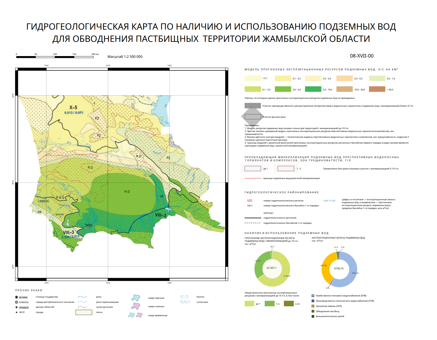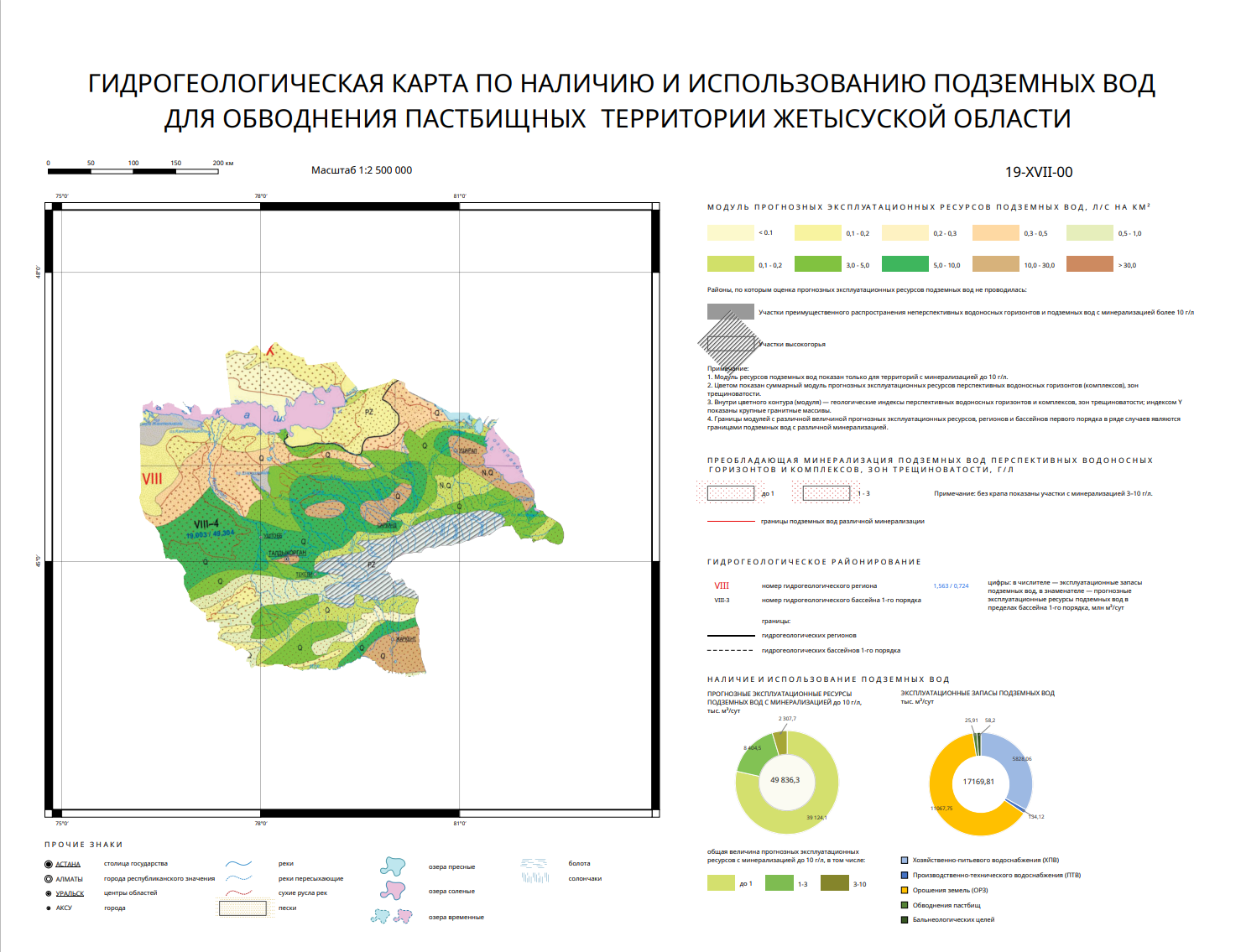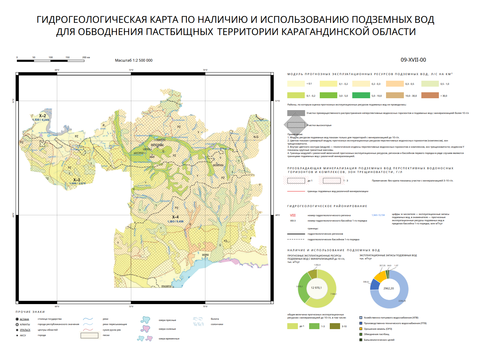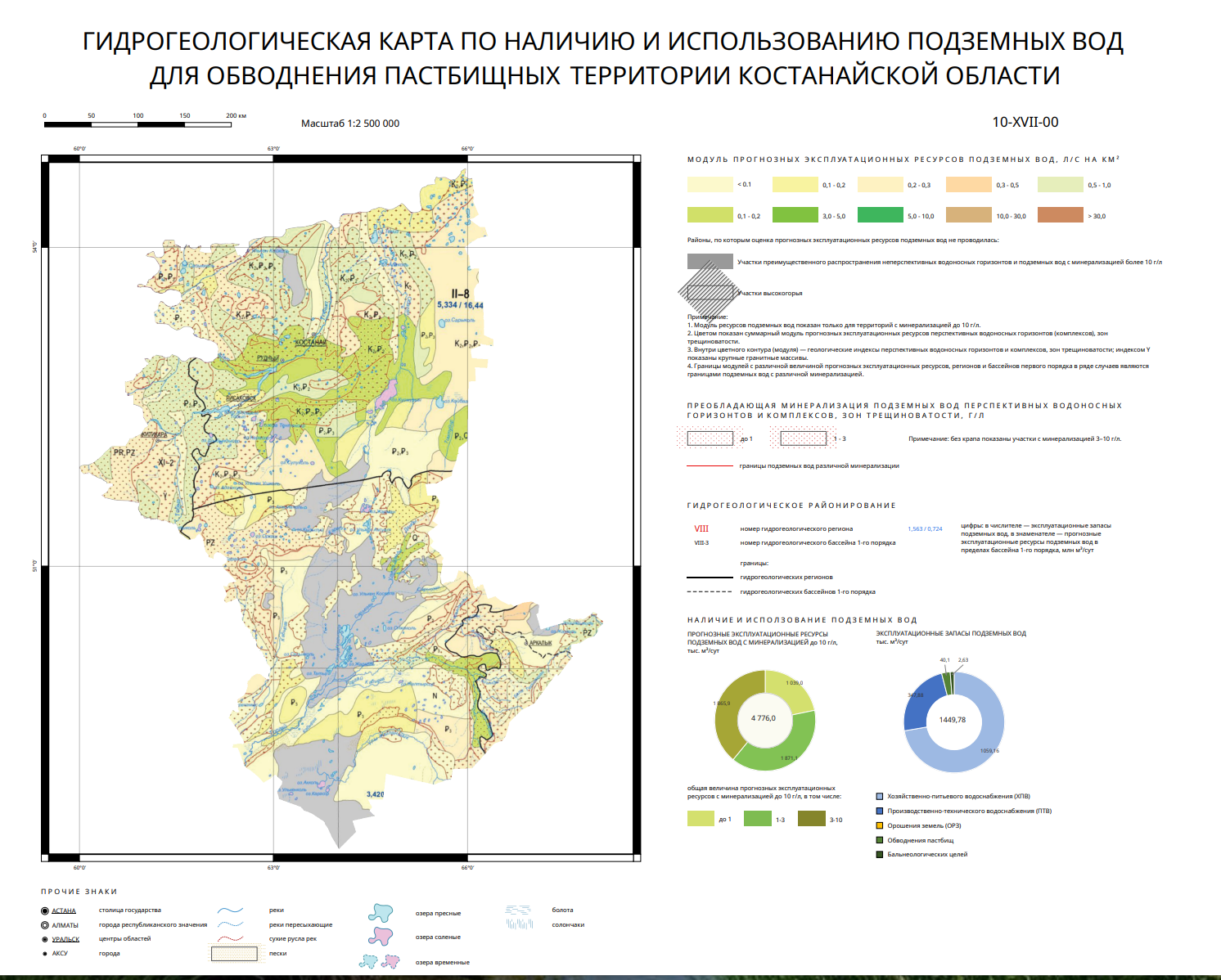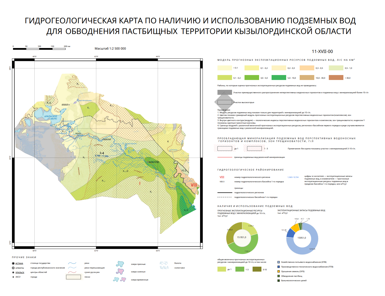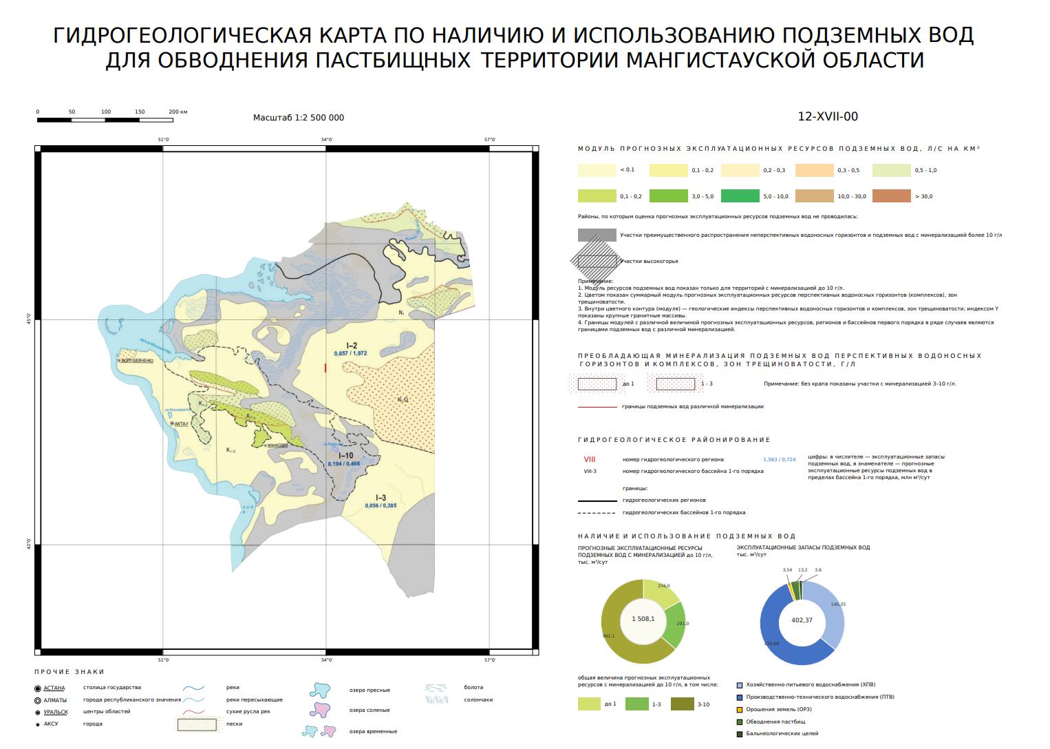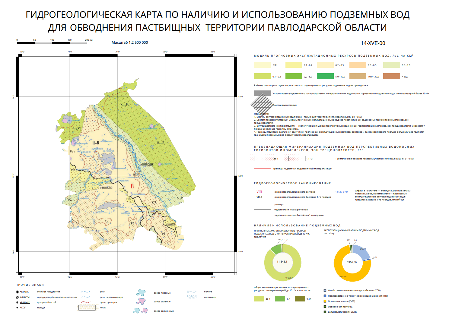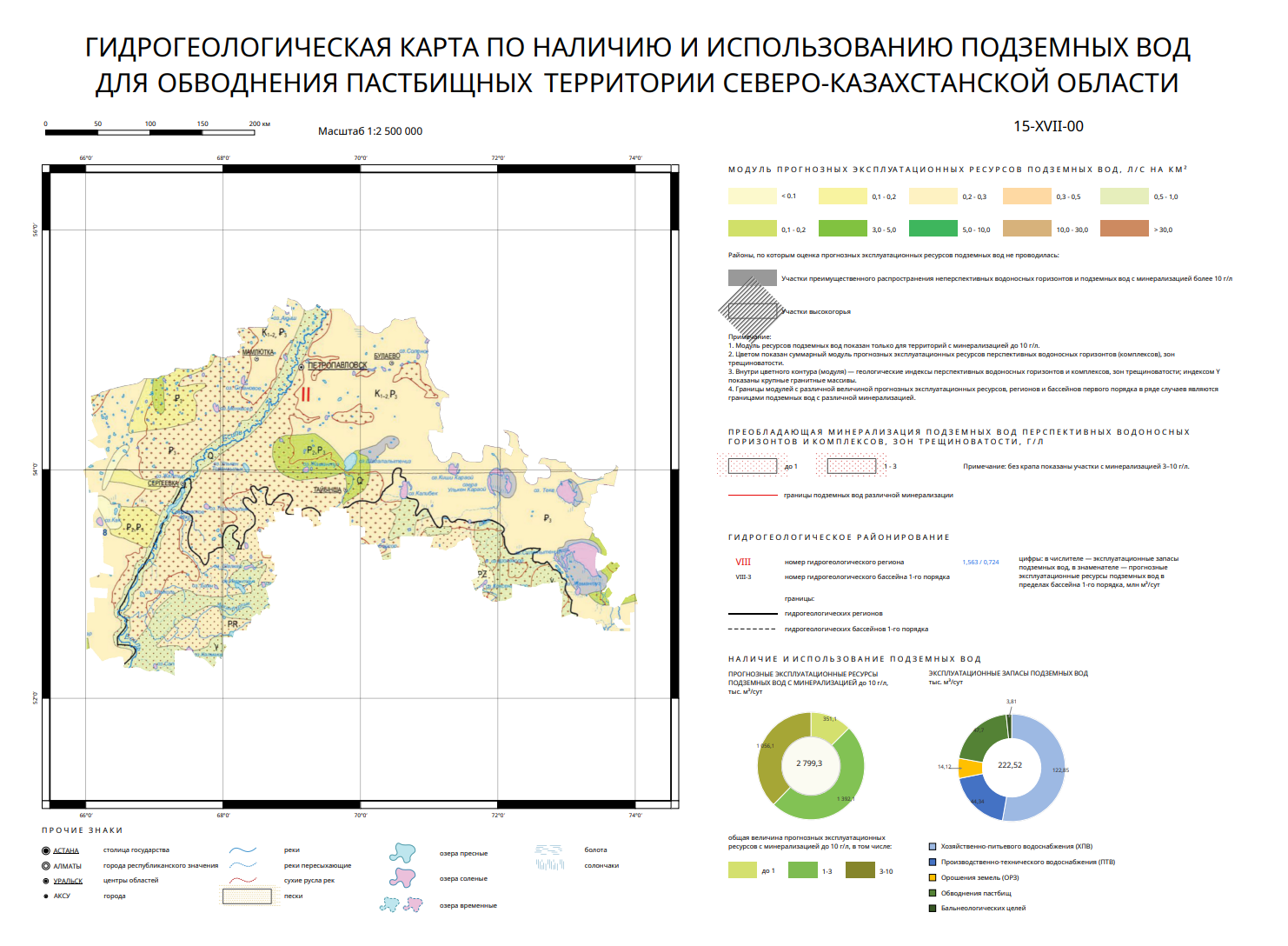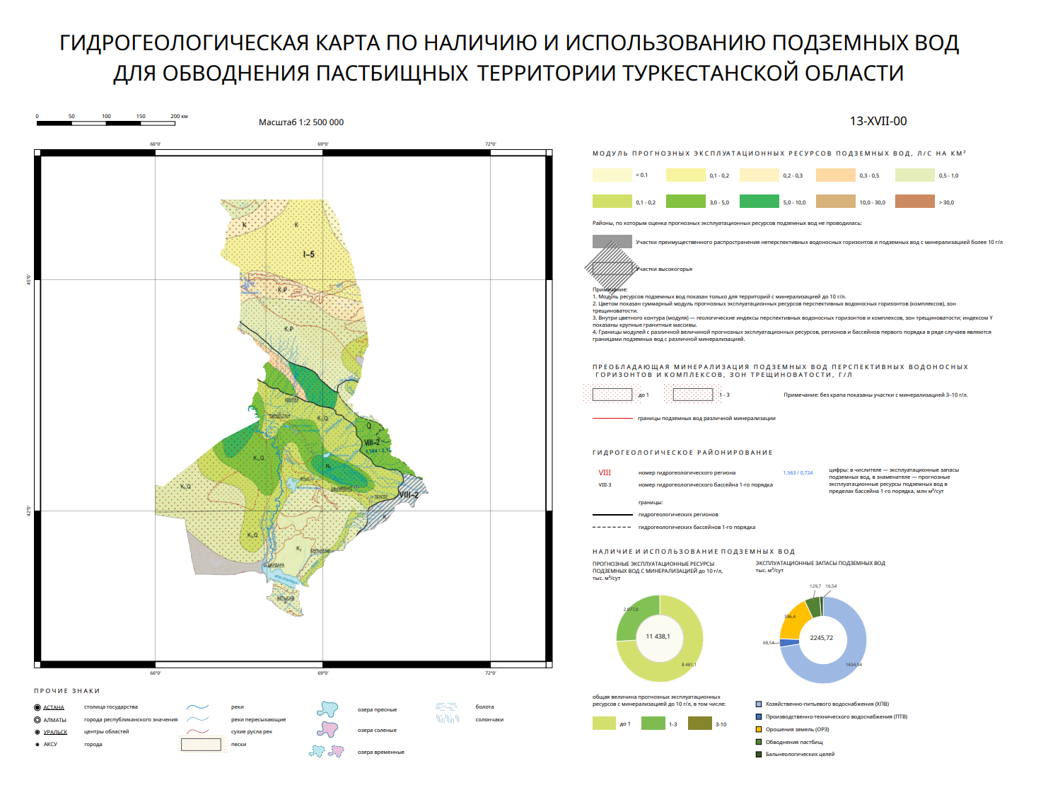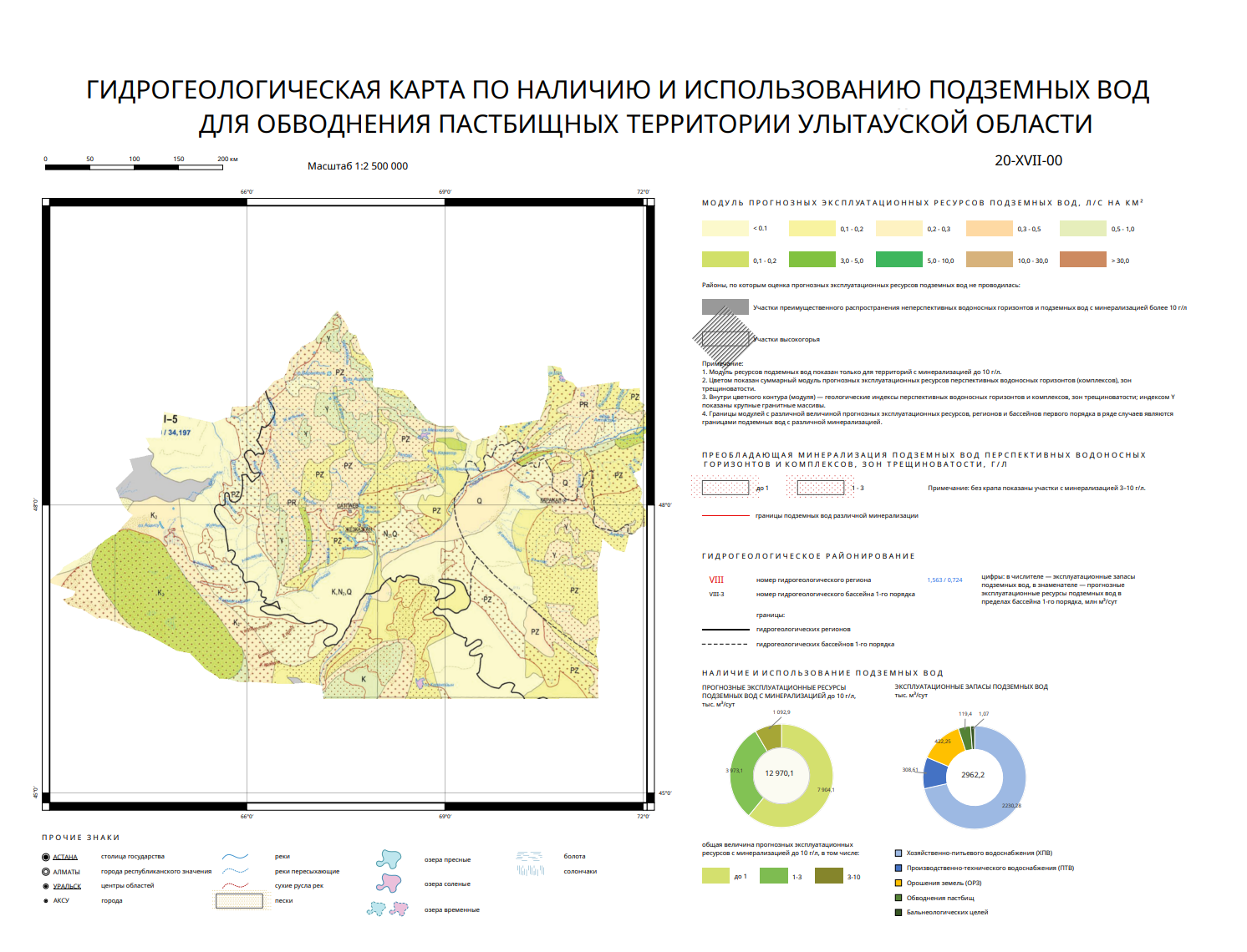
Hydrogeological maps on the availability and use of groundwater for irrigation of pasture areas
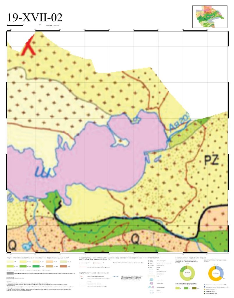
The Agricultural Water Supply Department of Kazakh Scientific Research Institute of Water Management LLP has developed hydrogeological maps – at a scale of 1:200,000 – covering the availability and use of groundwater for watering pasturelands across all regions of the Republic of Kazakhstan.These hydrogeological maps were produced under the scientific and technical program BR 22883585, “Development of effective technologies for enhancing the productive capacity and rational use of pastures,” specifically within the project component “Development of methods for the effective watering of pastures in the Republic of Kazakhstan using groundwater.”